
Past and Present: The Penny Bridge
We’ll be back to new posts next week. Please enjoy another (updated) look at one of Brooklyn’s vanished landmarks. A Look at Brooklyn, then and now. Before Robert Moses created the Promenade, that great cantilevered compromise between preservation and progress, Montague Street used to stretch past Pierrepont Place, all the way down to Furman Street…
We’ll be back to new posts next week. Please enjoy another (updated) look at one of Brooklyn’s vanished landmarks.
A Look at Brooklyn, then and now.
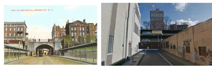
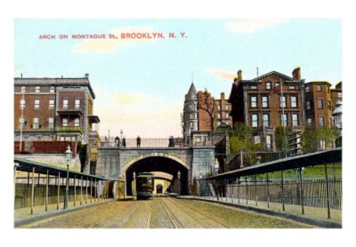
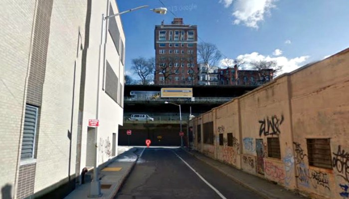
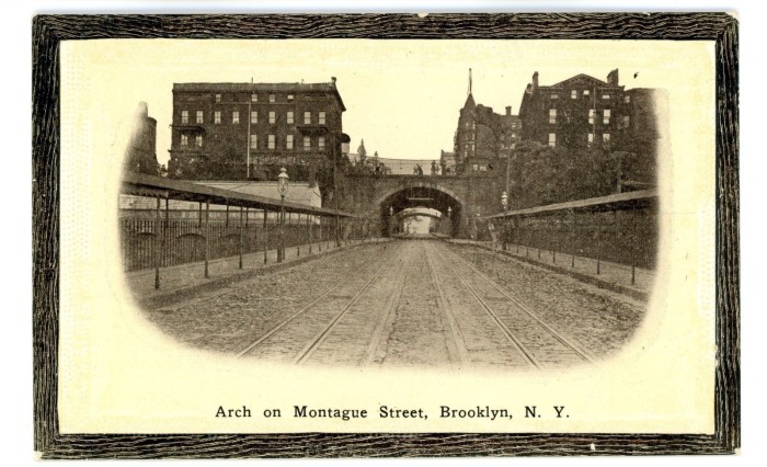
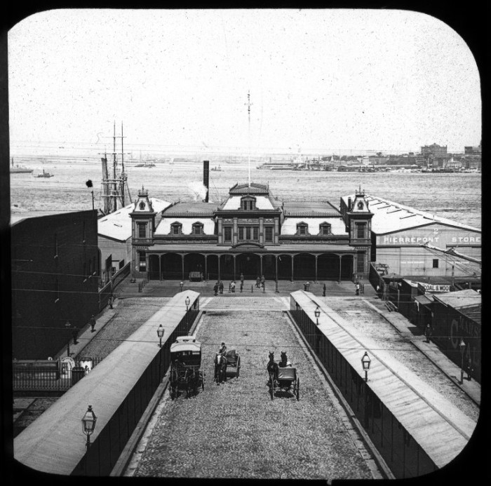
Before Robert Moses created the Promenade, that great cantilevered compromise between preservation and progress, Montague Street used to stretch past Pierrepont Place, all the way down to Furman Street and the piers. Brooklyn Heights has always stood high on a steep bluff above the shoreline, the topography is one of the reasons the land was picked for settlement in the first place. As business at the piers increased, the ability to get from the shore to the Heights without scaling steep hills necessitated the excavation of a level roadway for carriages, wagons, and later trolleys, cable cars and buses. An iron bridge over an arched tunnel enabled pedestrians and vehicles to pass above.
In the 1850s, the great Brooklyn architect Minard Lefever designed the Penny Bridge, a broad arched roadway leading down to the Wall Street Ferry, at the base of Montague St. This was all cut from the old Pierrepont estate, as were the later Pierrepont and Montague Terraces. These two streets were also connected to the Penny Bridge by another small iron bridge. The area became a romantic assignation spot, and promenading, in the true sense of the word, was quite popular.The Wall Street Ferry began operating in 1852. The Brooklyn Bridge opened in 1883, changing everything, but the Wall St. Ferry continued to run, as it was very convenient for Brooklyn Heights’ Wall Street men, who preferred the quiet ferry to the crowded bridge.
By 1883, the clamoring began for a better way to take that steep hill. Heights residents wanted a cable car trolley to carry them up and down from the Ferry to the Heights proper. In 1891, that cable operated trolley went into operation. There were several accidents during its run, including one in 1892 where the cable snapped, sending the car, the driver and six passengers into a padded retaining wall built for that purpose. Only the driver was hurt.
But, the Wall St. Ferry, and the cable car were done in by progress, in the form of the subway. The ferry stopped running in 1912. But the cable car lasted until 1924. The road, the bridges and tunnel were all destroyed for the Promenade (officially called the Esplanade) in 1946.
This postcard dates from around 1905. You can see the greenhouse belonging to the Low family, whose house is on the hill directly above, on the left, and the tower of Montrose Morris’ Arlington Apartments peeking up behind the bridge, on the right. GMAP
What's Your Take? Leave a Comment