
City Looks to Rezone Gowanus, Add Public Space Along Canal, According to New Planning Study
The long-awaited Draft Planning and Land Use Framework of Gowanus has just been released by the Department of City Planning.

Photo by Craig Hubert
The long-awaited Draft Planning and Land Use Framework of Gowanus has just been released by the Department of City Planning. Previous attempts to rezone the area have been in the works for over a decade.
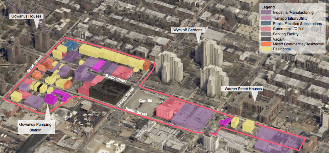
At 188 pages, which can be read here, the study is broken down in detailed sections, including “Sustainability and Resiliency,” “Environmental Remediation,” “Community and Cultural Resources,” “Housing,” “Economic and Job Development,” “Transportation” and “Land Use and Urban Form.”
It is the culmination of 100 hours of outreach since the launch of the Gowanus PLACES Study in 2016, as well as “informed” by the previous Bridging Gowanus Study that was released in 2014, according to the report.
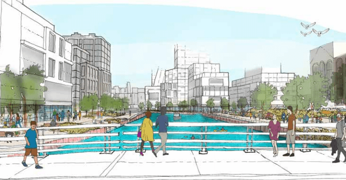
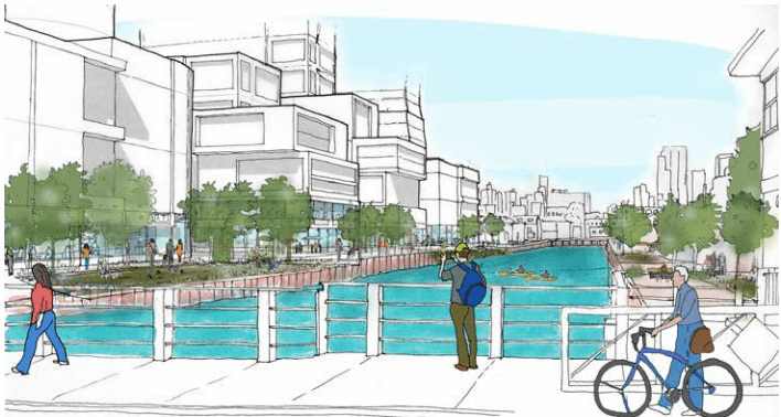
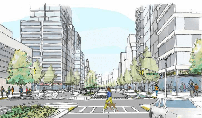
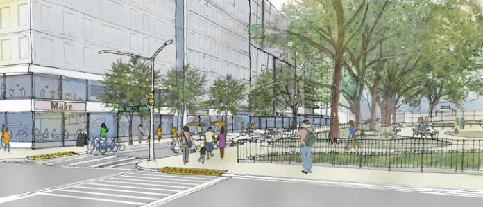
Some of the things that immediately jump out: moves to allow higher density mixed-use development around Thomas Greene Playground and 3rd Avenue, facilitate public access along the Canal and permit residential development along the Gowanus Canal “at a medium to moderate density.”
Sketches included in the report, which can be seen above and below, give an indication of how this will look.
A rezoning from industrial to residential is likely to dramatically increase the value of rezoned property and be a bonanza for current owners of industrial property in the area.
The next step in the process is the development of the Neighborhood Plan and Draft Zoning Proposal, which the report predicts will be finished by the winter of 2018. After that, the proposal will go through the official public review process known as ULURP.
There will be an open house to discuss the framework on Wednesday, June 27 from 5 to 8:30 p.m. at P.S. 32 at 317 Hoyt Street. The DCP will be in attendance.
In May, a coalition of local and city-wide groups, as well as residents, renewed a call for landmarking the area, providing a list of proposed sites in Gowanus for individual, scenic and historic district designation.
The report states that DCP will “encourage use of federal and state historic preservation tax credits for eligible properties,” identify spots that are eligible for landmark designation and research expansion of the Carroll Gardens Historic District.
In 2014, the New York State Preservation Office decided not to move forward with a plan to designate the Gowanus Canal area as a state and national historic district. The designation, which had been in the works for about a decade, was shelved after the state received a substantial number of notarized letters from property owners objecting to it.
Meanwhile, work on remediating the toxic canal, one of the nation’s largest Superfund sites, is just beginning and won’t be finished for a number of years.
Related Stories
- As Rezoning Looms, Gowanus Locals Renew Push to Landmark Area, Reveal List of Key Sites
- City’s Latest Proposal for Public Space in Gowanus Canal Cleanup Meets With Conflicting Responses
- Locals Question $1.2 Billion Cost of Gowanus Canal Tank Project, Say Gowanus Station Can Be Saved
Email tips@brownstoner.com with further comments, questions or tips. Follow Brownstoner on Twitter and Instagram, and like us on Facebook.

What's Your Take? Leave a Comment