
Past and Present: The Montague Street Slip
A look at Brooklyn, then and now. Today’s Past and Present is a rare look at a Brooklyn none of us will see again. This is the Montague Street Slip, on the East River, below Brooklyn Heights. The photograph was taken in 1915, and shows a part of Brooklyn that is forever gone. This is…
A look at Brooklyn, then and now.
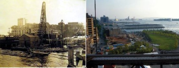
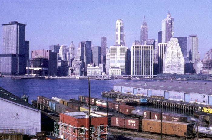
Today’s Past and Present is a rare look at a Brooklyn none of us will see again. This is the Montague Street Slip, on the East River, below Brooklyn Heights. The photograph was taken in 1915, and shows a part of Brooklyn that is forever gone. This is part of the world of Brooklyn’s working waterfront, which once stretched from Greenpoint to Bay Ridge.
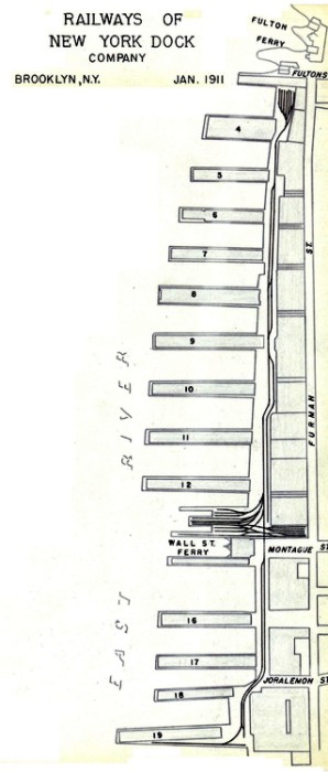
This area was the heart of Fulton Terminal, one of three dock terminals operated by the New York Dock Railway. The other two were the Baltic Terminal at the base of Baltic Street and the Atlantic Terminal, at the base of Commerce Street. Between all three terminals, the NY Dock owned the waterfront from Brooklyn Heights to the end of Red Hook. In addition to the piers, the company also owned the storehouses the stretched along the waterfront, a distance of two and a half miles. These were all brick storehouses with arched openings, similar to the Empire Stores and the Tobacco Warehouse on Water Street.
These stores and the piers had originally been owned by the Pierrepont, Clinton, Woodruff, McCormick, Robert, Prentis and other families whose names now grace our streets and institutions. These were the New England merchants who built Brooklyn in the early 19th century, making fortunes on the import and export of produce, grain, tobacco, sugar, coffee, leather, rubber and other commodities. For much of the 19th century, they operated as the Brooklyn Wharf and Warehouse Company. NY Dock bought the entire site in the largest bankruptcy sale in Brooklyn history, up to that point, in 1901, and began operation.
The Fulton Terminal was a floating dock terminal. It had a large wooden pier that held four tracks. These were used mostly as storage of railway cars. On both sides of the pier were the floating bridges. These piers floated on pontoons, although later the wooden piers were replaced by girder float bridges. These piers received the float cars that were pushed by tugboats.
The float cars were barges holding a railway car on a track. The cars came from New Jersey and the Bronx, and were floated across the water and eased between the floating bridges, where the cars would be lifted from the barges and placed on the pier’s railroad tracks, and on to nearby warehouses for loading or unloading. The railway cars then made the land trip to their other destinations across the country. It was a very efficient system; a rail car could be loaded and unloaded in a short amount of time.
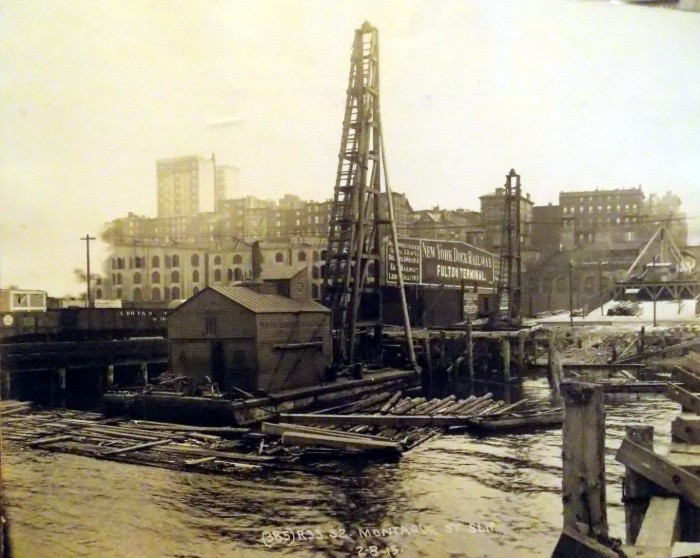
By the teens, subway tunnels were being built underneath the East River from Manhattan to Brooklyn Heights, and construction of those tunnels necessitated a rebuilding of some of the NY Docks piers, specifically the Montague Street Slip, the pier located near the Montague Street to Wall Street ferry terminal. One of the subway tunnels was right under it. Our period photograph shows the pier under reconstruction.
The large crane in the center of the photograph is sitting on a barge, anchored next to the dock that they appear to be demolishing or repairing. The rest of the dock is in the foreground of the picture. The barge also is supporting a cabin which was used to store equipment and serve as a staging area. Behind the crane, on shore, is one of the NY Dock Railway’s buildings, with its signage visible from the river as well as from the streets in the Heights above. Another crane sits on shore.
To the right of the Docks building can be seen more construction materials, probably connected to the building of the subway tunnel beneath it. Further to the right, out of the picture, stood the Wall Street Ferry Terminal. A covered roadway and a cable trolley car leading up Montague Street to the Heights ran up and down the steep hill. The Wall Street Ferry was a very busy and convenient form of transportation for those working in Lower Manhattan. Until the subways were completed, the ferry was much faster for Wall Streeters than the Brooklyn Bridge, dropping them off right in the financial district.
On the left side of the crane barge, the railroad tracks of the pier can be seen. Many different rail lines ran out of the Fulton Docks, including the Lehigh Valley Railroad, as seen in the picture. Behind the piers, running along Furman Street, can be seen a group of the docks many warehouses; their arched doorways stretched from one end of the photo to the other.
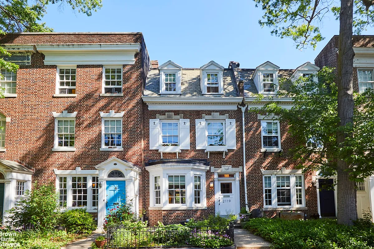
And lastly, above it all rises the backs of the houses built along Columbia Terrace, all of which had back views of the harbor. Some of Brooklyn’s wealthiest people, the ones who had built the warehouses on the docks, had lived here. Individual mansions can be made out. The tall towers on the left are probably the Hotel Margaret, also on Columbia Terrace.
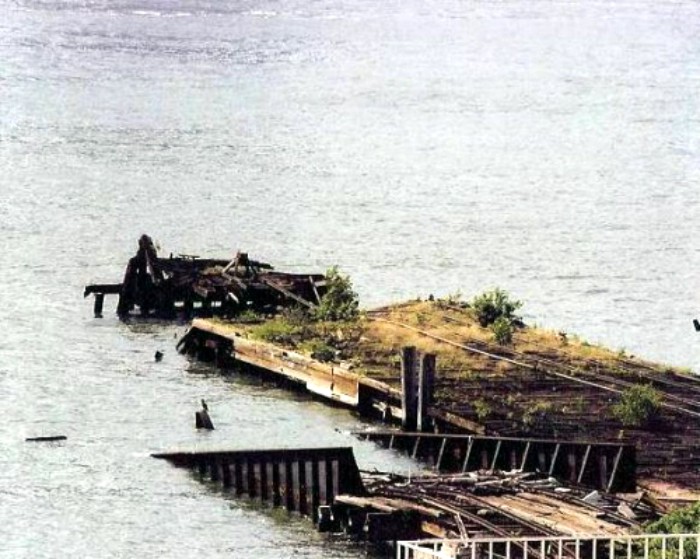
The warehouses were all torn down by 1954, to make way for the BQE. The Hotel Margaret burned down in a horrific fire in 1980. The Wall Street Ferry stopped running in 1912, done in by the subway, which was faster and held more people. The terminal was torn down, and the cable car discontinued. As we all know, the face of waterfront changed forever with the creation of the Promenade and the highway system created by Robert Moses in the late 1940s and early 50s.
The Fulton Terminal ceased operations in 1983. The piers and many of the remaining buildings were abandoned and left to rot. The riverfront was under the administrations of the Port Authority, which leased the intact piers to industry. But much of it was still an unused eyesore. The idea of a park had been around for years. There was already a small state park under the Brooklyn Bridge, but city planners and residents wanted much more.
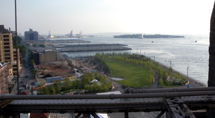
Between 2002 and the present, the piers and dockland of Fulton Terminal have been transformed into parkland, creating the new, multi-purpose Brooklyn Bridge Park. The state park was folded into BBP, creating 85 acres of riverfront parkland, from Main Street and the Empire and Tobacco Warehouse sites in Dumbo, to Atlantic Avenue. The Montague Slip was between today’s Piers 3 and 4. Nature, with a lot of help from man, has once again taken over the waterfront. GMAP
The history of our working waterfront is fascinating. Many others think so, as well, especially train enthusiasts. The best website for information on Brooklyn’s piers and waterfront is trainweb.com. It’s got tons of info on all of the docks and piers along Brooklyn’s shore line. You can get lost for hours. It was the source of most of my information for this article.


What's Your Take? Leave a Comment