
Floodgates, Seawalls Proposed for Sandy-Devastated Areas of Brooklyn
Ten years after Superstorm Sandy pummeled New York City, sea walls, storm surge barriers, and moveable sea gates may be coming to flood-prone parts of Brooklyn and Queens, the U.S. Army Corps of Engineers announced.

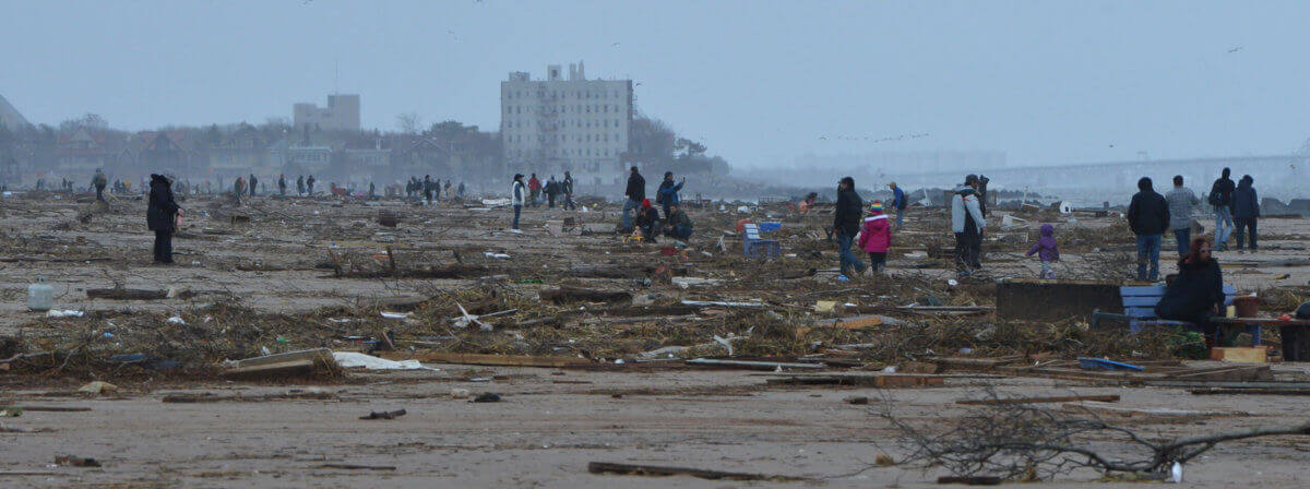
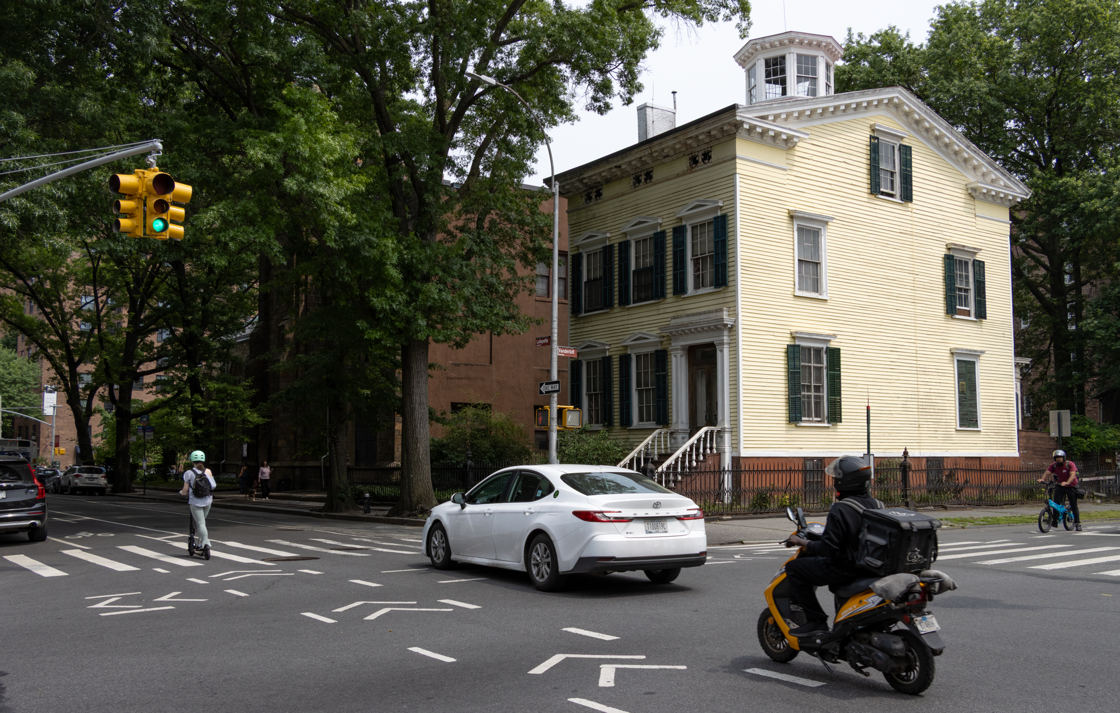
Superstorm Sandy flooded neighborhoods like Red Hook, pictured here, and Brooklyn’s low-lying coastal nabes are still at significant risk for catastrophic damage from storms. If approved and funded, the Army Corps’ plan would install miles of seawalls and other measures. Photo by Elizabeth Graham
Ten years after Superstorm Sandy pummeled New York City, sea walls, storm surge barriers and moveable sea gates may be coming to flood-prone parts of Brooklyn and Queens, the U.S. Army Corps of Engineers announced Monday.
In 2012, as the storm passed through, hundreds of thousands of people lost power, the city’s historic waterfront overflowed, mass transit systems and schools were shut down and many New Yorkers had to leave their home to find safer shelters. A decade later, some parts of the city — including Coney Island and Red Hook — are still recovering from the extensive damage the storm caused.
To protect New York and New Jersey, the two states hardest hit by the storm, from future disaster, the federal government allocated funds for a comprehensive infrastructure project. After years of study, the Army Corps, in partnership with local agencies including the New York Department of Environmental Conservation and the Mayor’s Office of Climate and Environmental Justice, have settled on a plan that includes a number of permanent storm surge barriers as well as temporary, deployable sea gates and flood barriers that would reduce damage to protect particularly vulnerable areas.
The draft plan and feasibility study was released to the public on Sept. 26, and the public is welcomed to submit their comments and feedback through January 2023.
‘A significant milestone’ in climate resiliency
“This is a significant milestone as we move towards a more resilient New York and New Jersey coastline,” said Colonel Matthew Luzzatto, commander, USACE, New York District, in a statement. “The Corps has been tasked with solving the Nation’s toughest engineering challenges, which includes making communities more adaptable and stronger in the face of powerful coastal storms that are becoming more frequent. This study will ensure we are prepared to do everything possible to provide additional coastal storm risk reduction measures to the communities we serve.”
The plan includes many adjustments along Brooklyn’s shores. In the northern part of the borough, the Army Corps proposes a storm surge barrier across Newtown Creek, which bisects Greenpoint and Long Island City, along with “shore-based measures” along the East River and the banks of Newtown Creek. Those “shore-based” elements could include raised walkways, earthen levees built along the shoreline, and deployable floodgates. “Deployable” floodgates remain open and unused until a storm rolls in, when they can be swung shut or raised from their resting position flat on the ground.
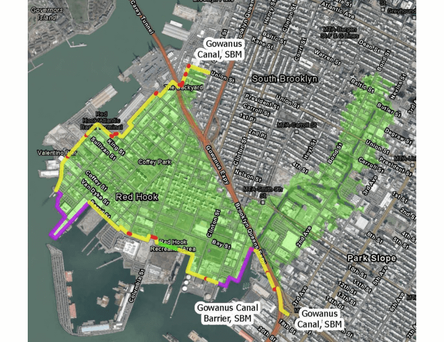
A little further south, in flood-prone Gowanus, the corps would install a storm surge barrier at the southern end of the canal, where it meets the Gowanus Bay, and install seawalls and floodwalls along the banks of the bay. The barriers at Newtown Creek and the Gowanus Canal would include gates so boats could still access the bodies.
Newtown Creek and the Gowanus Canal are both federal Superfund sites — heavily contaminated with chemicals left from Brooklyn’s industrial past, including carcinogens and other chemicals hazardous to human health and the environment. The cleanup of the Gowanus Canal is ongoing, but, 12 years after it was officially designated a Superfund, Newtown Creek is still waiting for action.
A critical component of the plan is the completion of the city’s Red Hook Coastal Resiliency project, according to the report. The city is expected to finalize a design for the RHCR by the end of this year, according to the report, with construction expected to begin in 2024. The project, which has been controversial in the neighborhood, focuses on the Atlantic Basin and Beard Street — two areas of Red Hook identified as particularly vulnerable to damaging floods.
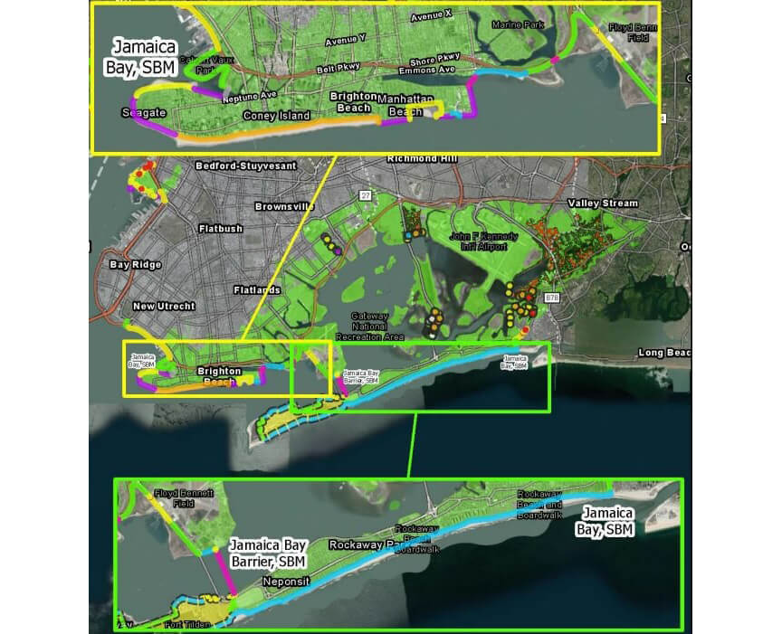
The southernmost parts of the borough would be almost entirely surrounded by sea walls, flood walls, and flood gates, according to the report. In Canarsie, floodwalls and erosion-preventing revetments are proposed to go up in the southwestern shore of Fresh Creek. Enormous storm surge barriers would be constructed along the coast of Sheepshead Bay and in the Gerritsen Creek, and coastal reinforcement measures including elevated walkways, reinforced dunes, and seawalls would stretch from New Utrecht to Floyd Bennet Field.
In Coney Island, which would be wrapped in sea walls and flood walls, the corps plans to install 14 green streets, depressed planted areas between the roadway pavement and the sidewalk, to help prevent flooding. Green streets absorb water and allow it to filter slowly back into the environment, slowing flooding — some greenstreets are already in use in Gowanus.
“New York State is committed to working with our local, state, and federal partners to address the impacts of climate change and particularly the increased risks of flooding in low and moderate-income areas,” said DEC commissioner Basil Seggos, in a statement. “These communities continue to suffer a devastating toll from coastal storms like Superstorm Sandy as well as other severe weather, and DEC looks forward to continuing to actively engage in the NYNJHAT process to help residents and municipalities prepare and prevent floods in the region.”
Coastal nabes still grapple with Sandy’s devastation
Superstorm Sandy was particularly devastating for public housing residents in Brooklyn’s coastal neighborhoods. Repairs at two New York Public Housing authority developments are ongoing in Coney Island, and, as of 2020, the original plans had to be altered when the project went over budget. Earlier this year, a botched Sandy-era repair knocked out gas service for hundreds of residents.
In Red Hook, contractors knocked down dozens of trees and left piles of dirt scattered throughout Red Hook Houses as part of a costly, overdue resiliency project. In 2014, the city’s parks department spent more than $700,000 on “emergency boiler reconstruction” caused by Superstorm Sandy at the Red Hook Recreation Center. Seven years later, Hurricane Ida knocked out the center’s boiler once again.
The federal government has not yet committed to funding the project, and is not required to provide the funds, according to the Associated Press, though Robert Freudenberg, a vice president with the Regional Plan Association, told the outlet Army Corps projects tend to be funded at higher rates than other spending requests. If the government does agree to spent its money, it will only cover 65% of the costs, according to the AP — state governments and local communities would have to foot the bill for the rest.
If approved and implemented, the proposed plan could impact ferry service in Greenpoint and at the future Coney Island Ferry Landing, according to the report. Construction would likely cause temporary disruption to local wildlife, though construction in the Jamaica Bay could impact feeding areas, according to the report. In contrast, the Army Corps points out, taking no action could lead to more severe, long-term habitat disruption as storms and erosions wear away natural areas.
Some environmental groups, including the Newtown Creek Alliance and Gowanus Canal Conservancy, have previously said seawalls and gates may be ineffective and too difficult to coordinate, especially as the Superfund cleanups in Brooklyn continue.
Work would not begin until 2030 at the earliest, and would not be completed until 2044.
“This study is an important step towards comprehensive evaluation of coastal hazards along our harbor,” said Kizzy Charles-Guzman, Executive Director of the New York City Mayor’s Office of Climate and Environmental Justice. “As we enter the public comment period, dialogue with frontline communities will be essential to ensure we are advancing solutions that achieve multiple and equitable benefits. We look forward to a continued successful partnership with USACE, New York State and New Jersey.”
Read more about the plan and find out how to submit public comment online or via mail here.
Editor’s note: A version of this story originally ran in Brooklyn Paper. Click here to see the original story.
Related Stories
- Hurricane Sandy: It’s Still Not Over for Many Brooklyn Residents
- UN Climate Change Report Predicts Dire Future for New York
- Report: Brooklyn Still Not Recovered From Hurricane Sandy
Email tips@brownstoner.com with further comments, questions or tips. Follow Brownstoner on Twitter and Instagram, and like us on Facebook.


What's Your Take? Leave a Comment