
Traverse the Hidden History of the Gowanus Canal With a Walking Tour This Weekend
Discover the Gowanus Canal’s environmental history and how the community can plan for a better future along Brooklyn’s Nautical Purgatory at a walking tour around the waterway.

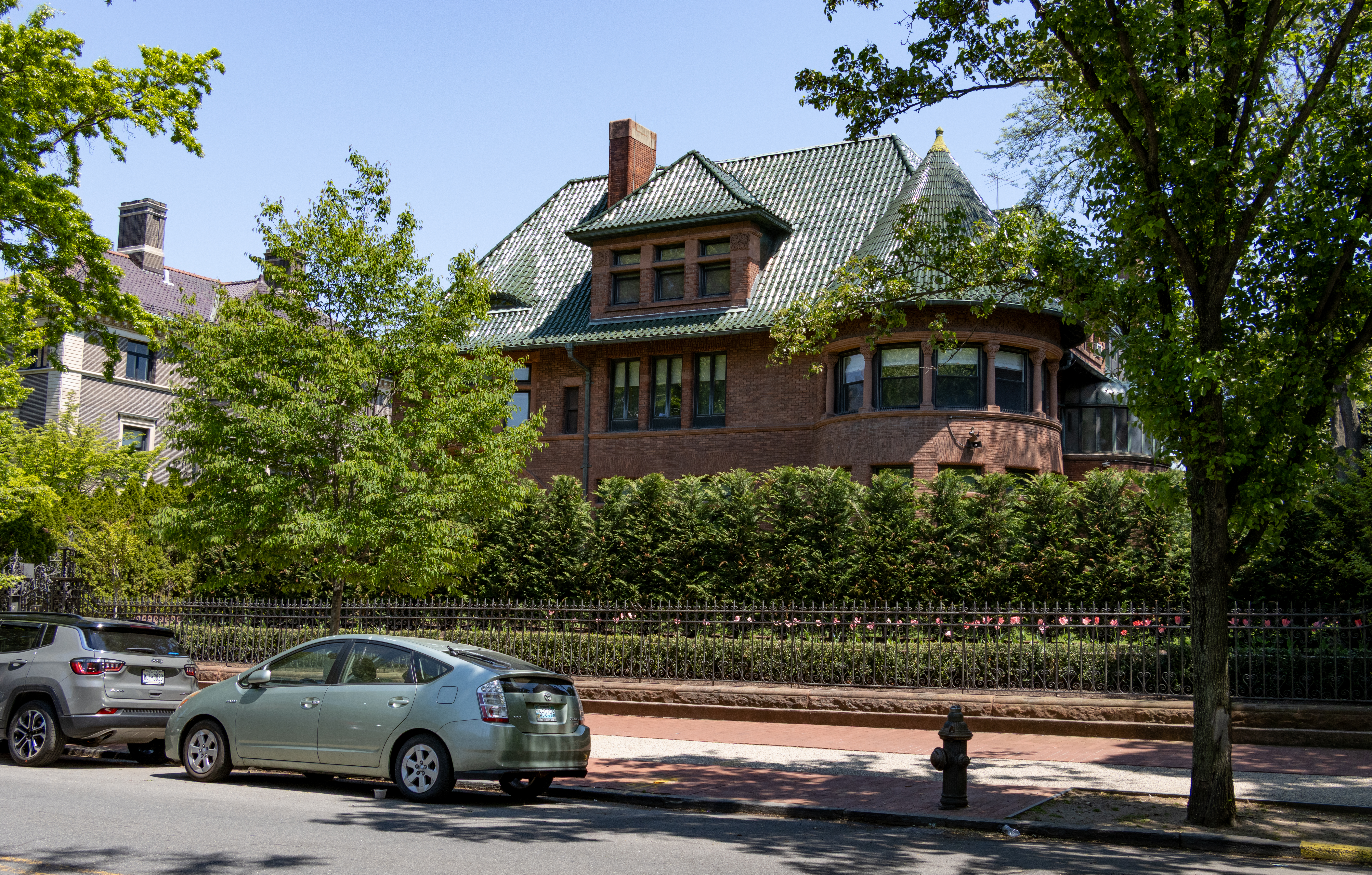
Photo by Susan De Vries
Discover the Gowanus Canal’s environmental history and how the community can plan for a better future along Brooklyn’s Nautical Purgatory at a walking tour around the waterway this Saturday, September 12.
The “Gowanus Watermark Walk” will trace historic marshlands and hidden “ghost streams” of the waterway’s pre-industrial past and tie them into the neighborhood’s future under the federal cleanup of the canal, the area’s storm resiliency, and the city’s planned rezoning, according to one of the two tour guides.
“[Gowanus] is an embodiment of just all our society’s and economy’s relationship with nature,” said Steve Koller, a Park Slope-based environmental scientist who studies the intersection of flood management, urban infrastructure, and policy design at the University of Miami, Fla. “Spending time on the canal and learning more about the remediation it seemed to me like every possible urban water management problem and potential from a development standpoint is manifested in the Gowanus area.”
Koller wants to show how natural disasters such as Superstorm Sandy have affected Gowanus and how the city, state, and federal government agencies are prepping for future events, while cleaning up the noxious channel.
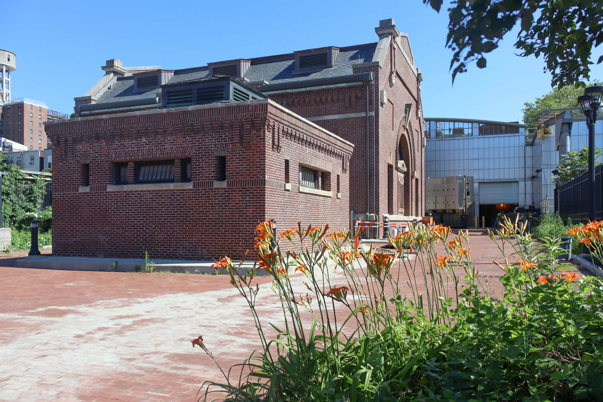
He will make stops at sites such as the century-old Flushing Tunnel, which pumps millions of gallons of highly-oxygenated water from the New York Harbor into the head of the canal, or the Gowanus Station House on Butler Street, where the city plans to install a filtration facility and an eight-million-gallon tank to capture raw sewage and stormwater runoff from flowing into the waterway.
The shore walk is sponsored by the Gowanus Dredgers Canoe Club as part of the citywide series of waterfront-themed event series the City of Water Day, hosted by the Waterfront Alliance and the New York-New Jersey Harbor & Estuary Program.
The Dredgers will host several events along the canal that day, including canoe voyages, a street art tour, and musical performances, topped off by a canoe-borne brass band blowout in the evening.
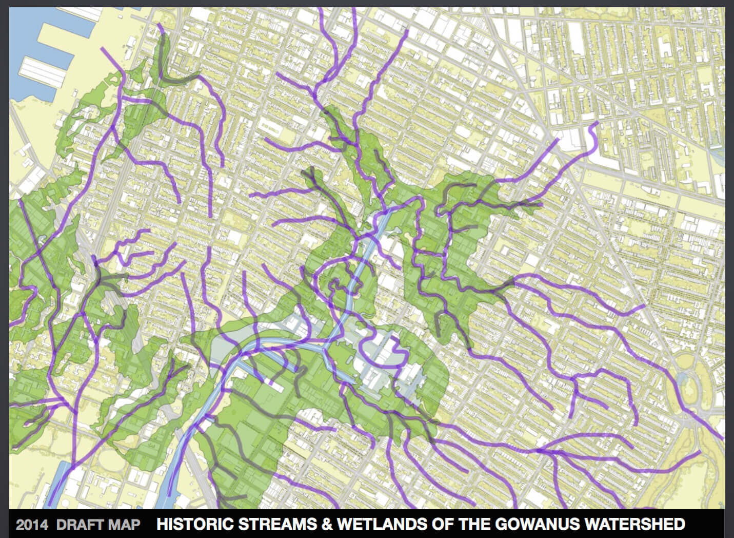
Gowanus boater, water sampler, and forensic geographer Eymund Diegel will join the educational stroll and talk about remnants of Gowanus past, such as old streams that can still be heard running underneath sewer plates.
Diegel overlaid early maps of the area with modern satellite pictures, showing some of the streams and how developers built on the old marshlands.
For example, rows of residential buildings like brownstones and other townhouses were usually built on islands of glacial debris known as moraine, because developers didn’t want to waste time filling in the marshland, according to Diegel.
“You can literally see it by staring at Google Earth, any building that was 20 feet wide was on a moraine island,” he said.
Other clues are potholes which can indicate a possible stream bed in the ground below, according to Diegel, who said that knowing the natural landscape helps to better build on it and harness the water’s energy, which can help avoid flooding.
“We’ve lost touch with some of the essential truths of the landscape, like if you build at the bottom of a hill in a natural pond you will get flooded,” he said.
Diegel pointed to paving over the old streams, which he believes has led to streets caving in or in one particularly bad case the collapse of a canal bulkhead near the Lowe’s parking lot in 2017, DNAinfo reported.
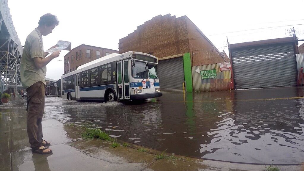
“We need to build the landscape so we don’t need to keep patching it,” Diegel said.
The tour guides hope to shed light on the area’s history and environmental challenges as the city eyes to rezone Gowanus to allow for more residents to live in taller buildings along the canal.
Koller said the rezoning has the potential to make the old industrial neighborhood a more ecological and affordable area, but hopes that the city doesn’t offload the environmental burden on the area’s neediest.
“Who is going to benefit from the amenities around the Gowanus and who is going to bear the cost of negatives of being close to the canal,” the scientist said.
The Gowanus Watermark Walk starts rain or shine outside Mirror in the Woods at 572 Union Street, between 3rd and 4th avenues in Gowanus. Tickets are $5 and registration is required. For more information visit the Dredgers event page online.
Editor’s note: A version of this story originally ran in Brooklyn Paper. Click here to see the original story.
Related Stories
- City Planning Hopes to Push Gowanus Rezoning Through Public Review Before Mayoral Change
- Gowanus Dredgers Launch Crowd-Sourced List of Local Businesses in Need of Community Support
- As Gowanus Rezoning Looms, City Designates Five Industrial Buildings as Historic Landmarks
Sign up for amNY’s COVID-19 newsletter to stay up to date on the latest coronavirus news throughout New York City. Email tips@brownstoner.com with further comments, questions or tips. Follow Brownstoner on Twitter and Instagram, and like us on Facebook.
What's Your Take? Leave a Comment