
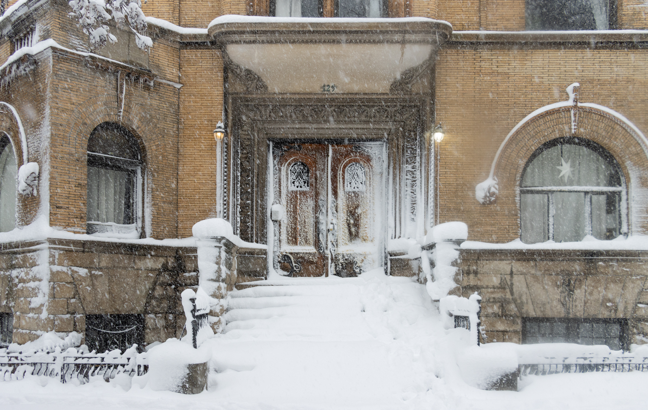
Living on Atlantic Avenue, the 'Spine of Central Brooklyn'
An industrial stretch of Atlantic Avenue has long been dominated by the railroad and automobile and now is giving way to large apartment buildings.

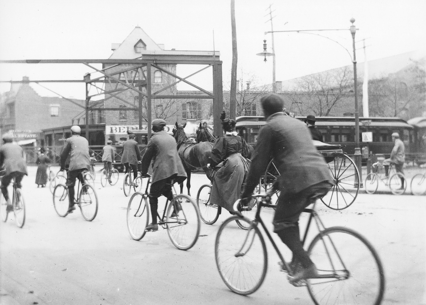
Atlantic Avenue and Fort Greene Place circa 1897. Image from Report of the Atlantic Avenue Commission via Library of Congress
People have lived on Brooklyn’s Atlantic Avenue almost as long as there has been an Atlantic Avenue. It started out as a path leading to early settler Ralph Patchen’s farm and then became a road to the East River. Part of it became known as Division Street, as it was the informal border between the town of Brooklyn and South Brooklyn, which included today’s Red Hook, Cobble Hill and Carroll Gardens neighborhoods. The thoroughfare continued to agrarian Queens and was a vital part of Brooklyn’s growth, as goods and produce made their way to the harbor.
By the 1850s, the entire road was known as Atlantic Street. By the 1870s, the street became an avenue. From the riverfront to Flatbush Avenue, it was a bustling shopping and commercial district. Businesses near the river catered to the sea trade, along with retail storefronts of all kinds. This busy area also supported civic institutions and bank buildings, factories, houses of worship, restaurants, and saloons.
From the first tenements housing nearby riverfront factory workers to the lively blocks of mixed-use storefronts with apartments above and the late 20th century factory conversions, this part of Atlantic Avenue has long been home to thousands of people over the past two centuries. But other parts of the long avenue? Some yes, much not so much. But that is changing rapidly.
This story concentrates on Atlantic Avenue as it runs through Brooklyn from Flatbush Avenue and the Barclays Center towards Queens. The tale concludes at Eastern Parkway before the subway lines intersect at Broadway Junction. Along the way, Atlantic Avenue delineates the borderline between the communities of Fort Greene, Clinton Hill, and Bedford Stuyvesant to the north and Prospect Heights and Crown Heights to the south. The city called Atlantic Avenue “central Brooklyn’s spine” in a rezoning proposal, a fitting way to look at this most important stretch of road.
Flatbush to Nostrand Avenue
The area around today’s Barclays Center has long been a transportation hub, with the Long Island Railroad terminal, the elevated trains above, and the trolley cars and wagons below. With all that going on, the blocks between Flatbush and Vanderbilt avenues were never residential. Warehouses, large factories, meatpacking companies, and other industrial buildings were concentrated here. The Atlantic Yards rail yard on the south side of the cut also prevented the construction of anything other than manufacturing or storage buildings.
It’s hard to imagine now, but up until the early 1900s, the Long Island Railroad ran on the street level from the Flatbush Avenue Terminal to Jamaica Avenue in Queens, on tracks laid down the middle of the avenue. The rails were flanked by east and west bound lanes for wagons and carriages and were fenced in, except at intersections. After the railroad put the tracks underground between Flatbush and Bedford avenues development picked up, but any residential units that existed were the product of mixed-use storefronts with apartments above. The mixed-use stores on the south side of Atlantic near Washington Avenue are among the few still standing. A perusal of historic maps shows a distinct lack of housing on this stretch.
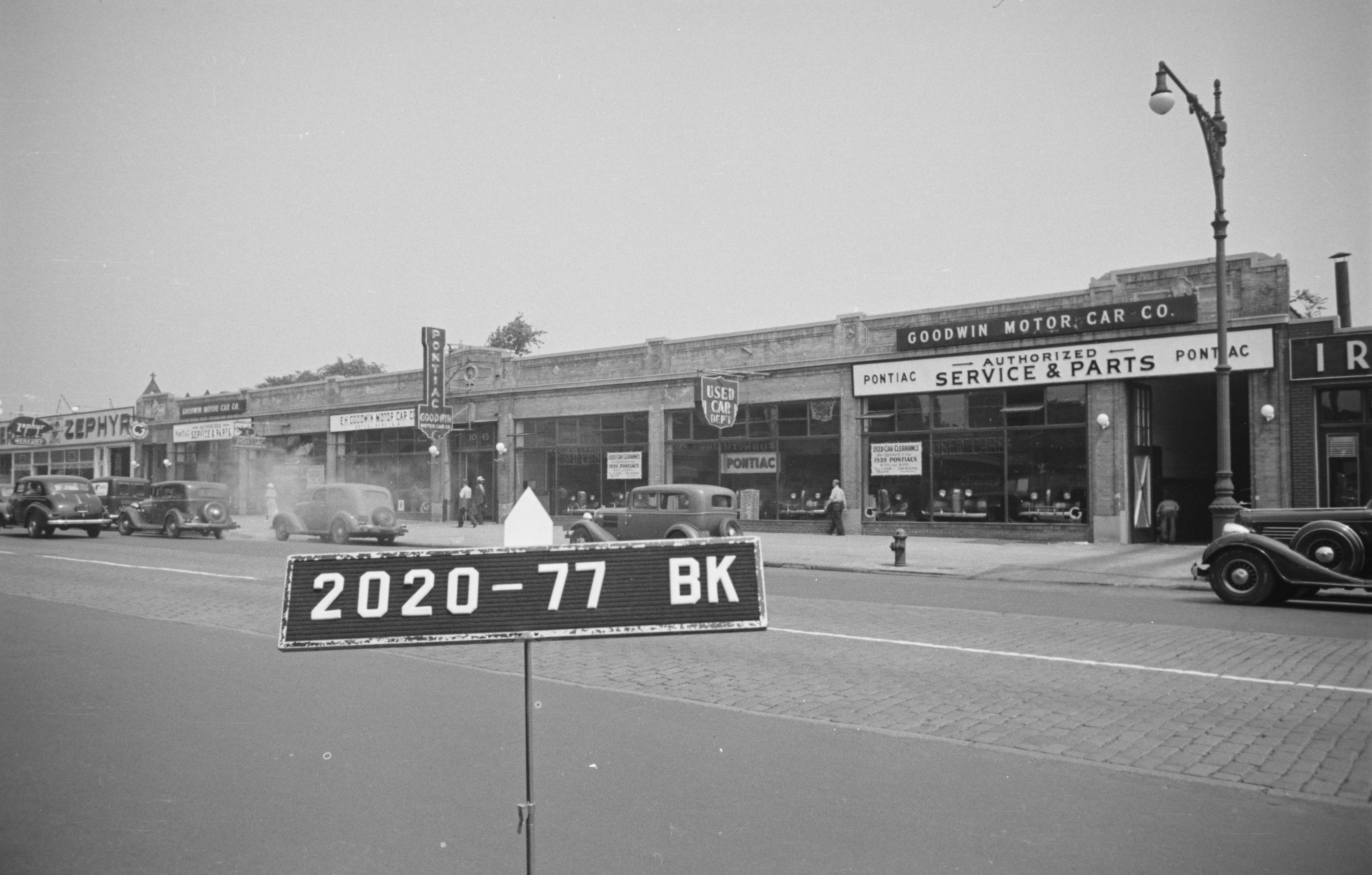
Because this area had never really been fully developed, the rise of the automobile in American society was the perfect opportunity for a massive number of car-related businesses to find homes on Atlantic. Soon there was a gas station at almost every corner, and the rest of the blocks were lined with tire and auto repair shops, service stations, garages, and other related businesses that shared the avenue with small contractors, electricians, window and glass suppliers, and other such enterprises. They were all housed in various sizes and architectural variations of one- and two-story inexpensive taxpayer-type brick buildings. A few larger factories and auto storage warehouses were also constructed. But no housing.
It wasn’t until the trains came up out of the tunnel by the Bedford Armory that things began to change.
Bedford to East New York Avenue
Records and maps show that a large, standalone wood-frame villa with ample grounds stood on the south side of the block of Atlantic between Bedford and Nostrand. It belonged to Stephen Pritchard, a wealthy English rubber merchant. He and his family lived there from the early 1870s until his death in 1895, records show, by which time they had moved around the corner to Pacific Street.
One of the reasons they may have moved is because of the railroad. Pritchard attended many city meetings where he was quite vocal about his opposition to steam engines running past his house. He lost. An 1896 photo of the above-ground train crossing at Bedford and Atlantic Avenue was taken only half a block from his house. Despite his opposition, Pritchard remained in the house for another 20-plus years. His home was torn down in the 1920s for the expansion of Charles Murray’s Metropolitan Engineering Company factory. (Now the building is a self-storage facility.)
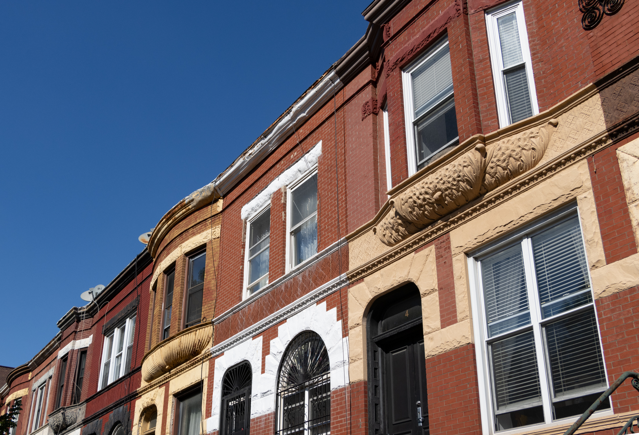
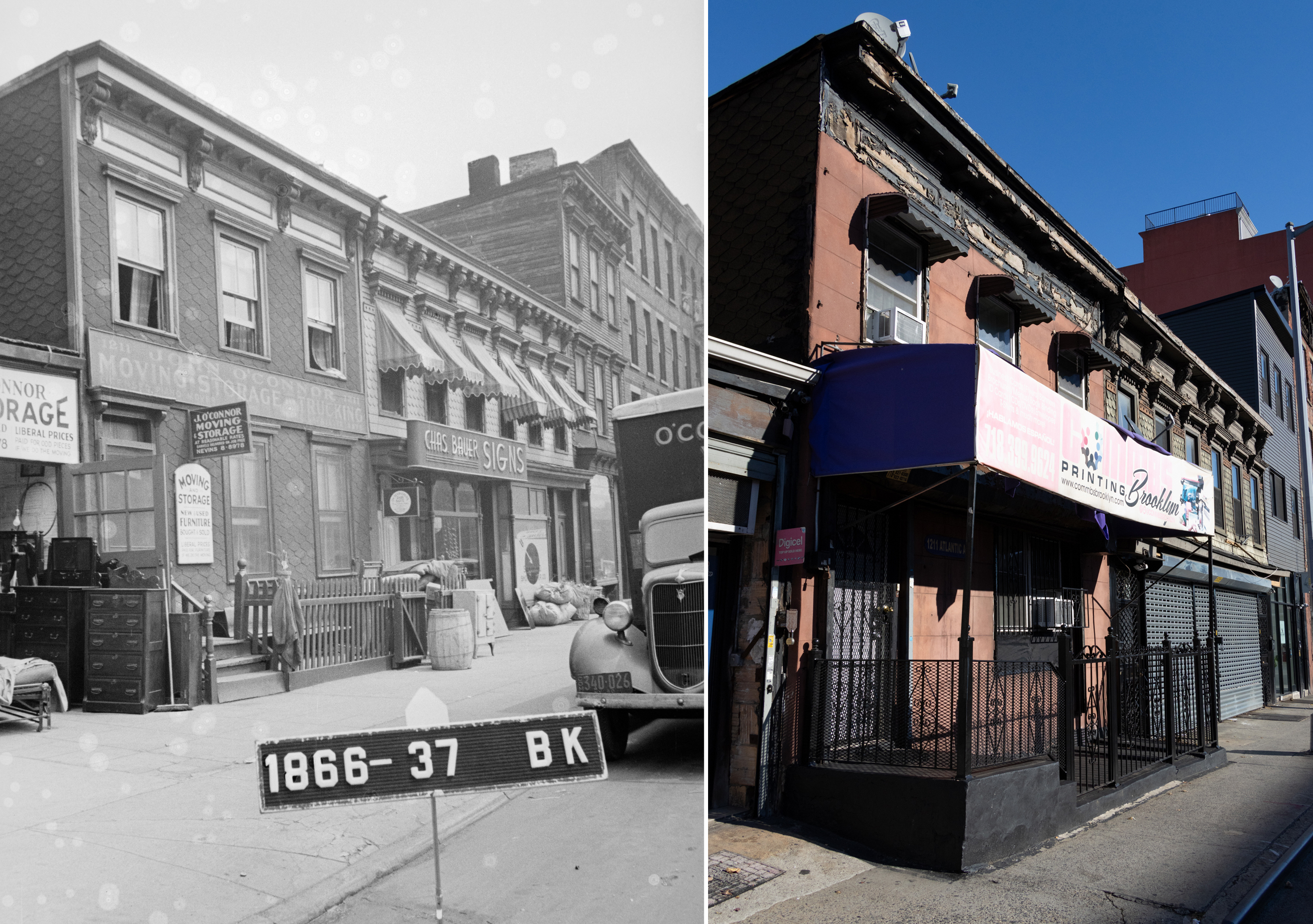
Across the street, five two-story frame houses, and three storefront frames join a row of four two-story dwellings, with another three-story wood-frame multi-use building and the large storefront on the corner of Nostrand. Of all of them, the two wood frames at 1213-1215 Atlantic are remarkably still standing and are more or less intact.
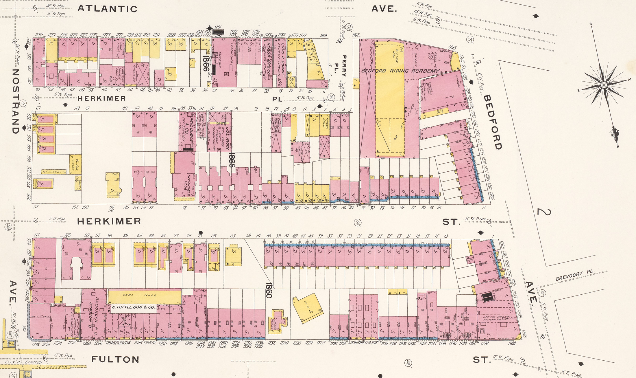
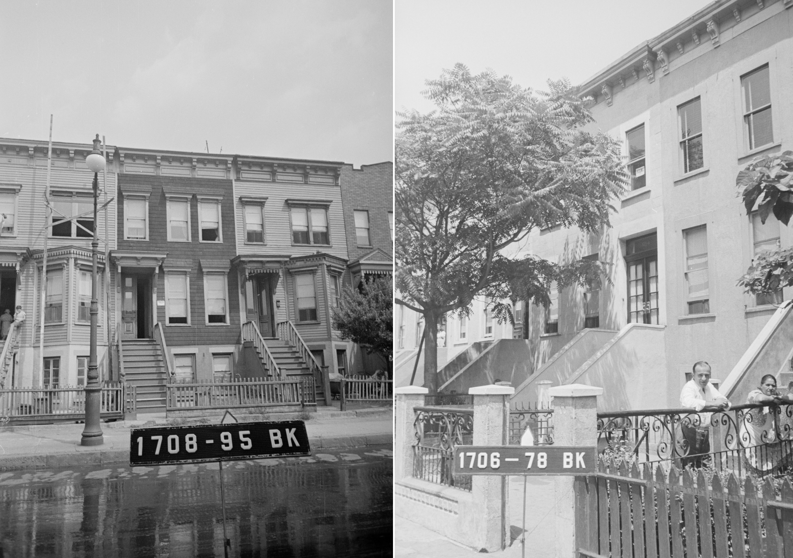
Despite the general consensus by real estate professionals in the early 20th century, Atlantic Avenue was not totally succumbing to lower property values with nothing but scores of auto businesses and factories. Period maps, specifically the 1904 Sanborn maps, show block upon block of housing between Nostrand and Eastern Parkway. There were narrow tenements, brick and brownstone row houses in several styles, larger walk-up flats buildings, and a plethora of attractive wood-framed row houses — especially the further east one traveled. All underneath the elevated railway.
Entire rows of homes once lined Atlantic, interspersed with an occasional garage, related business, or small factory. Today most are gone. The ones that still exist give only a hint of the residential life on the avenue. Most fascinating to peruse are the 1940s tax photos along Atlantic, which show intact rows of houses going eastward in Bedford Stuyvesant and Crown Heights North, all of which still stood until after the end of World War II.
After the war, new suburbs on Long Island were drawing white middle-class families out of the city. Aided by GI Bill subsidies, they moved to places like Levittown that were specially designed to attract families with the promise of affordability and exclusivity – most were segregated. A working man could afford a house with a lawn, a car in the driveway, and roads that would bring him into and out of the city for work.
Robert Moses, who gets both praised and blamed for his highway projects, had a hand in Atlantic Avenue’s mid-20th century development. He famously preferred cars and trucks to mass transit and freight trains. Atlantic Avenue is the only major east-west thoroughfare spanning the borough and continuing through Queens. Thousands of cars and trucks travel along its length every day.
Moses wanted to make it easier for traffic to get through Brooklyn, so he had the avenue widened under the LIRR elevated tracks east of Brooklyn Avenue. He created a middle turn lane and widened the other lanes. The south side of the avenue had many more blocks filled with commercial structures than the north side, so most of the widening of the road was done on the Bed Stuy side. Hundreds of houses and other buildings were torn down for the road expansion.
Census records show that this Atlantic Avenue housing in 1940 was predominantly working class, with occupations such as laborers, sewing machine operators, salespeople, building tradesmen, and teachers listed. The houses were two- or three-family buildings, and the owners and tenants were predominantly Italian Americans, with Eastern Europeans and Southern-born and Caribbean Black people living together on most blocks.
Some late Victorian cul-de-sacs and one-block enclaves were established in eastern Bed Stuy off Atlantic. Alice and Agate Courts were late-19th century factory owner and developer Florian Grojean’s pet project. The only way to get on or off these two blocks is via Atlantic Avenue.
Similarly, in the late 19th century, before 1904, an unknown developer laid out 15 one-block “places” joining Herkimer Street to Atlantic Avenue, such as Dewey Place and Jardine Place, all between Rochester and Van Sinderen avenues. They were all originally rows of modest attached homes, most of which are still standing, although many have been greatly altered. While the larger north-south avenues are two-way, almost all the “place” streets are one way, accessible only from Atlantic Avenue, tying them to greater Atlantic Avenue’s residential history.
And Now?
Nature, it is said, abhors a vacuum. Developers abhor under-built avenues, especially Atlantic Avenue. There wasn’t a lot of interest in construction there until the 2010s, when Brooklyn became the most desirable place to live in New York. As brownstone Brooklyn gentrified and rents soared upward, Atlantic Avenue was looked at as the perfect place for mixed-income housing.
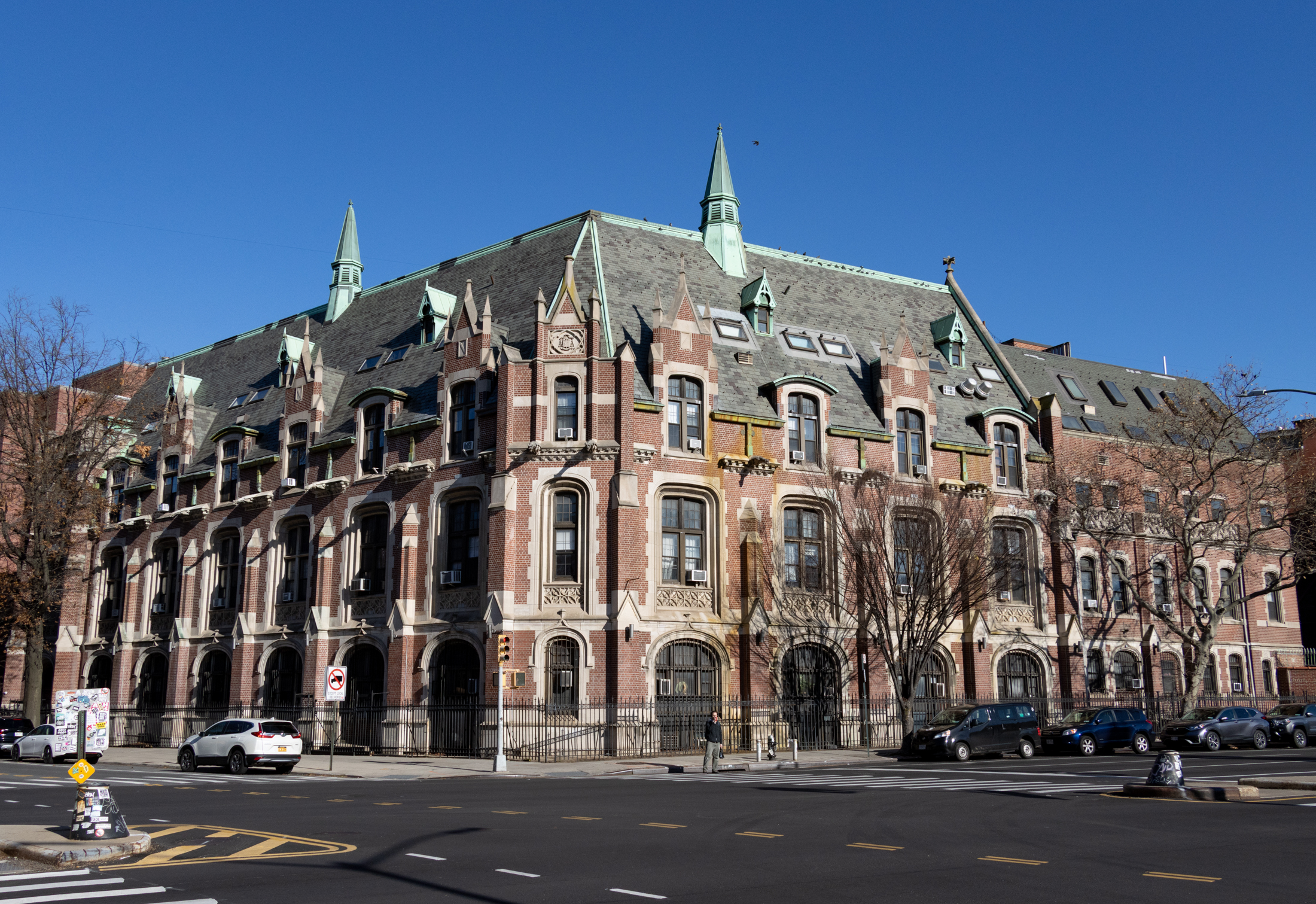
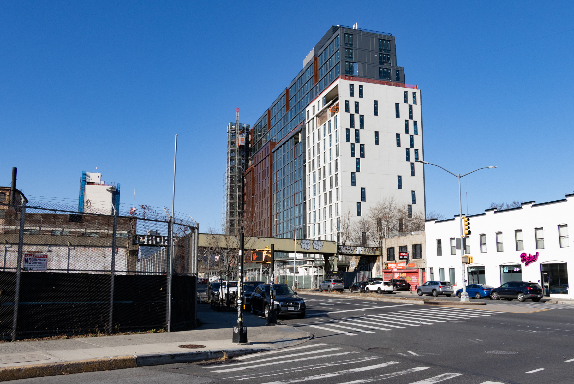
The large apartment buildings around Atlantic Yards, most of which were built as luxury condos or rentals, were the starting points for a permanent change on Atlantic between Vanderbilt and Bedford. With the notable exception of the Cathedral Condominiums, adaptive reuse housing in a former Catholic boy’s academy on the corner of Washington Avenue, there were no other single large apartment building on that stretch. Auto shops and factory/warehouses turned self-storage buildings were the norm. But one by one, or block by block in some cases, these buildings are rapidly disappearing and are being replaced by very large apartment buildings.
The largest is a half-block-long building still under construction on the northern side of Atlantic between Classon and Franklin. The stretch was previously home to a row of one-story auto businesses, as can be seen in the 1940 tax photo. The facades on these buildings had all been altered into plain boxes by the 1980 tax photos, so this row was certainly not remembered by most but is part of a growing trend.
The new Atlantic Avenue Mixed Use Plan rezoning recently approved by the City Council will greatly transform this area above the LIRR tracks. New housing is planned, both “affordable” and market rate. Mixed-use commercial/residential buildings are also planned, bringing both homes and jobs to this area, once zoned only for commercial and industrial use. Green spaces will be added and it is hoped the area will be more pedestrian friendly, although that seems unlikely given Atlantic’s heavy traffic. The rezoned area also extends to some blocks on both Crown Heights North and Bedford Stuyvesant sides. Hopefully historic brownstone blocks and other important buildings will not be torn down or allowed to be overbuilt.
A couple of tall glass and steel apartment buildings have gone up on and near Ralph Avenue in an area of Bed Stuy that has seen a lot of gentrification lately but not very much investment in jobs or quality of life. They stand as harbingers of what is to come.
The results of the rezoning, which will take many years to complete, could create a mini city of tall buildings on both sides of the avenue. Atlantic Avenue itself shows no sign of becoming less busy, and more people mean more cars and the need for more parking. Having a vehicle in Brooklyn is more popular than ever, despite the proliferation of public transportation. Gas stations that were once a staple of Atlantic Avenue are disappearing fast, as the land is worth much more for development. Adversely, as more cars come into the neighborhoods, the number of gas stations decline rapidly, a citywide issue.
Has living on Atlantic Avenue come full circle? Miles of garages and service stations replaced by new residential construction, and entire residential blocks destroyed for expanded roads. The automobile, in one way or another, continues to rule Atlantic Avenue. The “Spine of Central Brooklyn” continues to change back and forth with the times.
Related Stories
- From Mansions to Housing for Navy Yard Workers: The Clinton Hill Co-ops Story
- The Walled City: Brooklyn Heights’ East River Warehouses
- How the Railroad Brought Meatpacking to Fort Greene
Email tips@brownstoner.com with further comments, questions or tips. Follow Brownstoner on X and Instagram, and like us on Facebook.
My father’s family owned McLoughlin’s on Atlantic Ave across from LIRR. I believe PC Richard is there now. Future article about bars of the past on Atlantic Ave. would be great.