
A Walk in Far Rockaway
Far Rockaway seems to be Miss Havisham-esque doyenne whose beauty has long-since faded. No border between New York City and any surrounding community could be more stark: this is where the suburban ritziness of Nassau County’s Five Towns (Inwood, Hewlett, Lawrence, Woodmere and Cedarhurst) meets the inner-city grittiness of New York City. Tiffany-windowed churches stand…

Far Rockaway seems to be Miss Havisham-esque doyenne whose beauty has long-since faded. No border between New York City and any surrounding community could be more stark: this is where the suburban ritziness of Nassau County’s Five Towns (Inwood, Hewlett, Lawrence, Woodmere and Cedarhurst) meets the inner-city grittiness of New York City. Tiffany-windowed churches stand near inner-city projects. Far Rock is a thriving neighborhood and there are surprising elements to it that make it ripe for urban exploration.
Take the A train. Like a trident, the A train has a 3-pronged terminus in Queens: Far Rockaway (above), as well as Rockaway Park on the western side of the Rockaway peninsula at Beach 116th Street, as well as Lefferts Boulevard in Ozone Park. Far Rockaway can also be reached via the Long Island Rail Road.
In Far Rockaway you will find a rare New York City example of railroad rehabilitation. As late as 1953 the Long Island Rail Road provided service from Penn Station all the way to Rockaway Park (with a change of train along the way). However, when its ancient wooden trestle spanning Jamaica Bay burned down that year, LIRR service was suspended and never revived. Enter the NYC Transit Authority, which rebuilt the span and connected it to the remaining section of its mostly torn-down Fulton Street El, and voila, subway service to Far Rockaway began in 1956. That was the last section of trackage the subways would add for passenger service until 1967!
Until the 1940s the LIRR operated on the Rockaway peninsula mostly at grade, until this lengthy concrete trestle was constructed to take the railroad above street traffic. It is the longest such trestle in the city (a much shorter one takes the IRT Flushing #7 line above Queens Boulevard in Sunnyside).
LIRR trackage was connected to the TA’s subway section till 1955 when it was severed.

Monument to Telawana, the “last of the Rockaway Indians;” photo by Jed Ziegler
The Canarsie Indians occupied what would become Far Rockaway and the Rockaway peninsula for thousands of years before the arrival of Europeans. Surprisingly, their ancient name for the place has stuck. “Rekowacky” meant “place of our people.” Passing through a variety of spellings in Dutch and English, the spelling was finally settled with Rockaway, which has become one of New York City’s most insistent place names. There’s Far Rockaway (how far, we’ll get into shortly), the Rockaway Peninsula, Rockaway Park, four “Rockaway” subway stations, East Rockaway in Nassau County, Rockaway Avenue and Rockaway Parkway in Brooklyn, Rockaway Boulevard, Rockaway Beach Boulevard, Rockaway Breezy Boulevard, Rockaway Freeway and Rockaway Point Boulevard in Queens, Rockaway Street in Staten Island, and Rockaway Turnpike in Nassau County (an extension of Rockaway Boulevard to be exact). I don’t think this is attributable to a great desire to honor the Indians, but from a pervasive lack of imagination on the part of city planners.
After Dutch rule of the New York City area was ended by the British in 1664, the Far Rockaway area passed through Governor Thomas Dongan, settler John Palmer and later, Richard Cornell, who owned vast acreage of land along the future Queens-Nassau border stretching from the North Shore south to the Five Towns and Far Rockaway. He made his summer home in Far Rockaway during his retirement, and upon his demise in 1694, he was buried in the Cornell family cemetery, which is still there at New Haven and Caffrey Avenues.

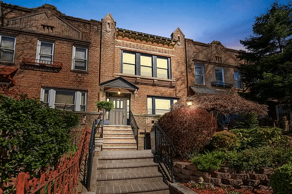
A mansion found along Mott Avenue in Bayswater. The neighborhood occupies the northwestern section of Far Rockaway along Norton Basin on the west and Mott Basin on the north.
Bayswater was a planned community laid out by developer William Trist Bailey, who purchased the swampy territory from the Cornells in 1878. It was home to yacht clubs and, as you can see, attracted a wealthy crowd with aristocratic pretensions. British-style fox hunts, complete with hounds, were once held here!
Bayswater is one of those NYC neighborhoods that nobody who lives outside the area has ever heard of. It’s tucked away far from Manhattan, and practically no mass transit intrudes here except the bus that goes up and down Mott Avenue, the street named for the prominent family that connects Far Rockaway’s three main neighborhoods (Bayswater, Far Rockaway proper, and Wavecrest).

The Long Island Rail Road Inwood station is just a few feet away from Queens, although it is situated in one of Nassau County’s Five Towns. Doughty Boulevard (right) parallels the city line for a few blocks without ever entering NYC. There’s a grade crossing over the LIRR. The 20-year-old Nassau Expressway (US878) is out of the picture to the right. Once planned to stretch to Kennedy Airport, it was built piecemeal; the part of it in the Five Towns reaches only to Rockaway Turnpike, which changes its name to Boulevard once it reaches the NYC line at Meadowmere Park. To the west of Doughty Boulevard, we encounter the Redfern Houses on the avenue of the same name in Queens.

Walking generally south along zigzaggy Virginia Street in a neighborhood of pleasant frame houses, there’s a real find at Bolton Road: a one-way sign of ancient vintage. NYC’s original one-way signs were white arrow-shaped signs with One-Way spelled out in black. They were replaced by the current flock of rectangular black signs in the 1970s after a midterm interregnum of white signs with black ‘arrowheads.’ Because of the city’s relentlessly thorough sign-replacement policy, an original one-way sign from the 1910s or 20s is rare indeed. But here it is, in one of NYC’s remotest outposts. Sharp-eyed observers will note upside-down type on the sign; it has been turned upside down over the years, and now points to a house instead of the actual direction traffic should go (see the newer sign adjacent to it).

For reasons known only to the long-gone people who named them, some streets in Far Rockaway are named for other Long Island communities, such as Hicksville, Brookhaven, Greenport, Plainview, and some not in Long Island, like New Haven and Virginia.
It’s not easy in 2015 to reach these Long Island towns directly from Far Rockaway by car and they were probably named in the days when the tin lizzie was your fastest means of transportation, or even a horse and cart.

Reach the beach. In its salad days Far Rockaway was a resort town par excellence and had dozens of Victorian mansions (enough to rival those in today’s Cape May, NJ) built near the water’s edge, as well as casinos, parks and nightclubs. Today the waterside mansions and clubs are all gone, remembered only in street names like Ostend Court, which recollects the old Ostend Hotel and Casino.
At right, there is a view of the Atlantic Beach Bridge, opened in 1952. Believe it or not, the bridge charged a 5¢ toll for pedestrians & cyclists, (and a quarter for cars) until the 1970s, when the bridge was finally paid for. You had to pay the toll and pass through a turnstile!

The Roy Reuther Houses near the Atlantic Beach Bridge is Far Rockaway’s tallest skyscraper. The project was built in 1971 under the auspices of the United Auto Workers. It’s visible for miles and, without any real competition, seems to rise straight out of the sand dunes. It is occupied mostly by retirees.

Though Richard Cornell was Far Rockaway’s first European settler, the Mott family was its most prominent landowner; Mott Avenue is Far Rockaway’s longest avenue (excepting Beach Channel Drive, which extends west to Jacob Riis Park near the Marine Parkway Bridge).
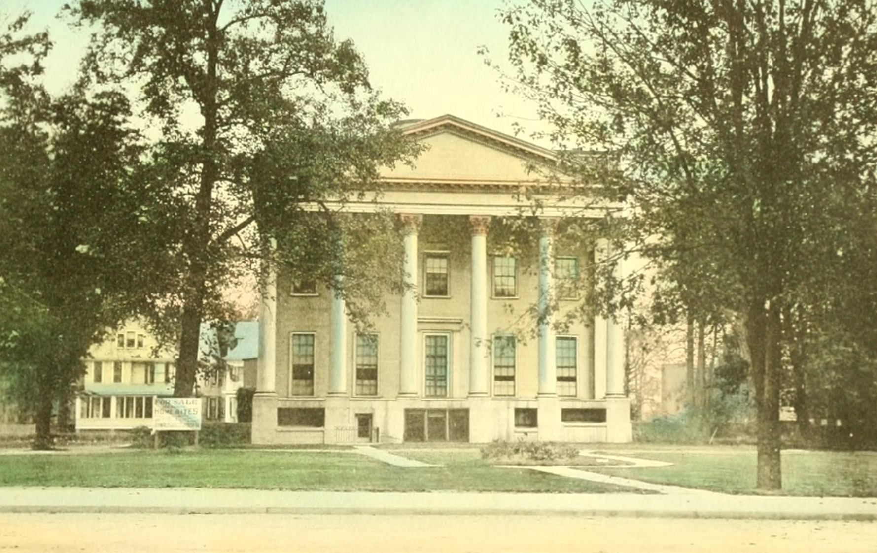
Mott Avenue begins inauspiciously at Frisco Avenue and Beach 13th Street, but picks up steam and by the time you cross Cornaga Avenue you are in the heart of Far Rockaway, where there are some interesting artifacts to be seen. Far Rock’s 1910s-era police precinct house is shown on the right side of the photo.

The old Rockaway News building on Central Avenue. Rockaway News started printing in 1900. Far Rockaway is currently served by The Wave, an even older newspaper which triumphed in the newspaper wars.


Far Rockaway’s post office on Mott Avenue is listed in the National Register of Historic Places, one of two Far Rock locations to be so designated (the other is Russell Sage Memorial Church on Beach 12th Street, which contains a large glass window designed by Louis Comfort Tiffany). Photo below is by Richie McCarey.

You ain’t seen nothin’ yet. The Strand Theater, on Beach 20th and Cornaga, opened as a vaudeville palace in 1919 and in the 20s, saw Al Jolson and Sophie (“Last of the Red Hot Mamas”) Tucker tread its boards. The Strand later became a movie theater and has been closed for nearly a quarter century. A medical office has taken over the ground floor since this photo was taken, and the marquee on the right has been removed.

St. John’s Episcopal Church, now the Beth El Temple on Mott Avenue, has survived since the 1880s and is one of the area’s oldest extant houses of worship.

Sometimes, modern architectural design (with the exception of Mr. Wright) gets a bad rap in my website Forgotten New York. Bell Boy Cleaners, up the block from the old Strand, is an exception; I like the building’s use of clean lines and bold, primary colors.

A touch of Far Rock’s seasonal legacy can be seen in this row of bungalows, like those that once lined each and every street from Wavecrest (a planned suburban community built from 1878-1880) all the way to Rockaway Park, about 3 miles west. Many have been abandoned or are in bad repair, but some of their owners still meticulously maintain them.
What is ‘far’ about Far Rockaway? I had always guessed it was named for its distance from the rest of Queens or from NYC, but it’s had this name from the start, even before it became a part of NYC beginning in 1898. It was so named for its distance west from the older town of Near Rockaway (now called East Rockaway). Both towns were originally in Queens County, but Near Rockaway became a part of the new Nassau County when Queens’ three eastern counties decided to secede (without firing a shot) in 1898, the same year Queens became part of NYC.
Kevin Walsh is the webmaster of Forgotten NY and the author of Forgotten New York and, with the Greater Astoria Historical Society, Forgotten Queens.


In the 40’s and 50’s, Far Rock was a great place to live and grow up. The A train station is on the corner of Mott and 22nd street. I lived on 22nd and watched them build the station. Also watched them build Redfern and Wave Crest. The Strand housed the PAL back then, along with 5 cent cokes and 10 cent buttered popcorn. The boardwalk ended on B19th street. The long beach bridge was there well before the bridge that is pictured. Watched them build the new one and tear down the old one.
In the early 60’s the LIRR discontinued the Rockaway Beach line which traveled from Mott Ave to Penn Station in about 42 minutes. My aunt worked in Macy’s Herald Square & commuted daily. Since the shutdown you either must drive (ugh) or spend 80+ miserable minutes on the A train. More than a few Rockawayites who worked in Manhattan moved to avoid the nightmare commute. Who can blame them? I lived in Rockaway then but was too young to understand what was happening. Does anybody remember when the LIRR line was closed-down? Why didn’t the community fight it? It was a horrible blow to middle-class commuters. The LIRR is a public agency–how could it screw the public like that? I never heard an explanation of why the line was discontinued. If the commute to Manhattan was manageable everything might have been different.
A wooden bridge over Jamaica Bay burned down, so there was no route for the trains to take, and the amount of people using the train daily wasn’t enough to convince the LIRR to spend all the money needed to build a new one.
I enjoyed the trip down memory lane of the town Far Rockaway I was born in (1946). My family was there since the early 1940’s and my. mother grew up in Rockaway Beach in early 1900s until late. 1930s. I’ve been in all the places described when it was a beautiful neighborhood. I lived near and used Bolton Road (the old one way sign photo) to get to Sage St, which was the side street my building was on- 750 Emplre Ave. It was the only apartment building among all private homes. (4 stories high). A wonderful place in which to grow up. I still have friends from there and we all say the same thing about it. Beach 9th St was where I spent my summers near the Atlantic Beach Bridge. We would get excited when it opened to let big boats through, which created the only small waves at that inlet. I now live on the other side of it in Long Beach. So many great times there. It was a safe, pretty ,quiet community.
Carl Ortiz you have a great memory and help me remember the great childhood we shared.I was 9 years old when my family moved from Manhattan to Far Rockaway [The Redfern Houses] where we were exposed to and not only accepted but embraced the incredible diversity that I wish we could help the generation we are living in now understand and appreciate. That was then and this is now I cherish the memories and wouldn’t change a thing!!
I was friends with your brother Erasto and my husband James is one of the Hannon family from Redfern. You know his brother Joey. I’m still friends with the DiSarlo family too. Great times!
I grew up in Far Rockaway in the 1950s and also attended P.S. 104 and the brand-new Cardozo Junior High. We moved to East Rockaway while I was in high school. We always referred to Central Avenue as “the village,” as in “I’m going to the village to do some shopping.
Far Rock was the in place at one time.The people from the 5 towns did their shopping there.Went to the movies and the beach.Central Ave was the place.Cedarhust was a ghost town.
How many remember when Far Rock was just called the “Village”